Pleasantville, Ontario
From Infogalactic: the planetary knowledge core
| Pleasantville | |
|---|---|
| Unincorporated community | |
| Coordinates: Lua error in package.lua at line 80: module 'strict' not found. | |
| Country | Canada |
| Province | Ontario |
| Regional municipality | York Region |
| Town | Whitchurch–Stouffville |
| Amalgamation | (With Village of Stouffville) 1 January 1971 |
| Government | |
| • Type | Municipality |
| • Mayor | Justin Altmann |
| • Councillor | Ken Ferdinands, Ward 1 |
| Elevation | 290 m (950 ft) |
| Time zone | EST (UTC−5) |
| • Summer (DST) | EDT (UTC−4) |
| Forward sortation area | L4A |
| Area code(s) | 905 and 289 |
Pleasantville is a community located in the Town of Whitchurch–Stouffville, Ontario, Canada.
It is a small hamlet consisting of mainly farms, residential homes and horse ranches.[1] Pleasantville was originally settled by Quakers from Pennsylvania in the early nineteenth century.[2]
Pleasantville is situated east of Highway 404 and can be reached from Vivian Sideroad (Mulock Drive) by driving north on Woodbine Avenue.
References
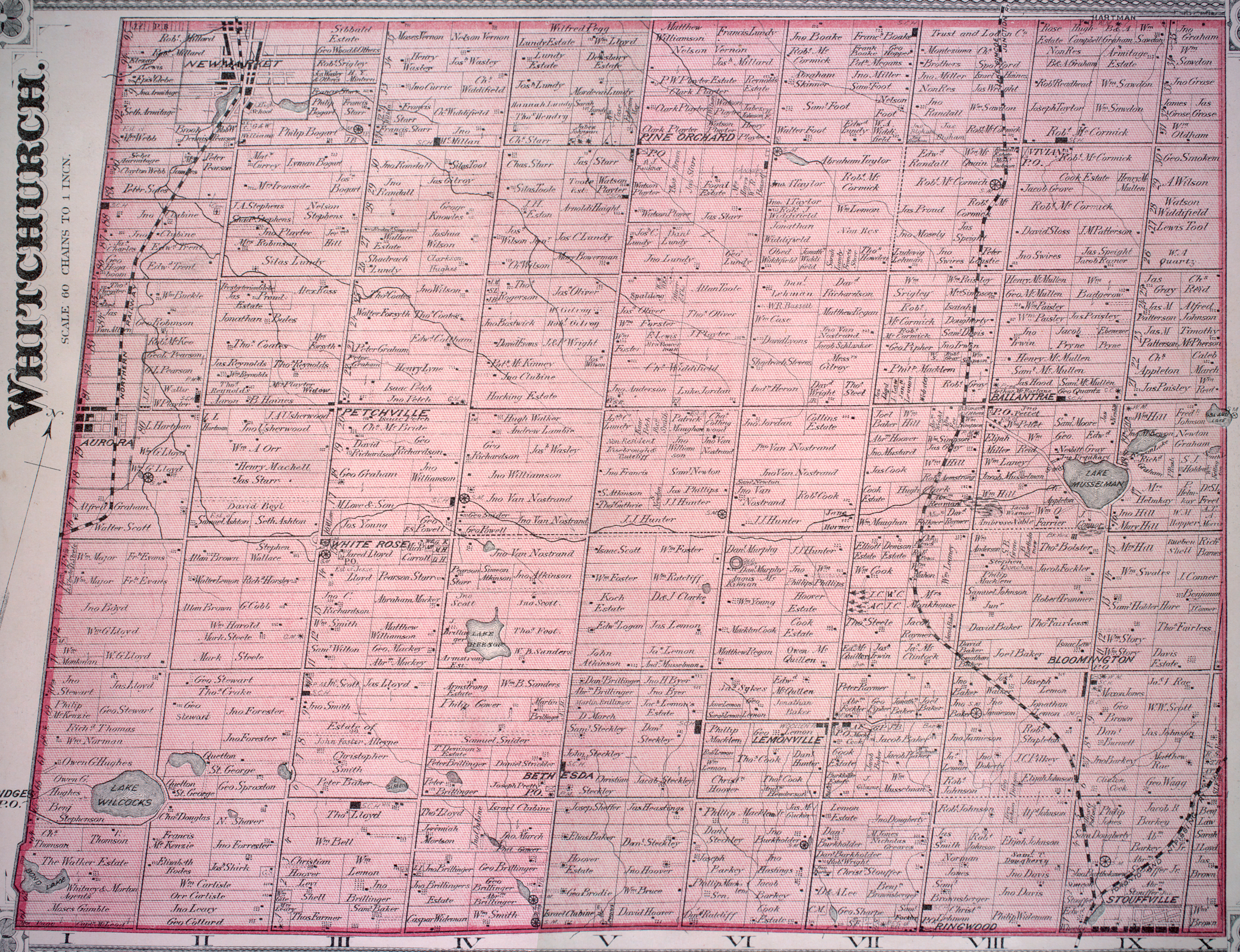
- ↑ See the detailed 1878 map: Township of Whitchurch, Illustrated historical atlas of the county of York and the township of West Gwillimbury & town of Bradford in the county of Simcoe, Ont. (Toronto: Miles & Co., 1878).
- ↑ For a brief history, cf. Jean Barkey et al, Whitchurch Township (Erin: Boston Mills, 1993), 71.
<templatestyles src="Asbox/styles.css"></templatestyles>
|
This Ontario geographical article about a location in the Golden Horseshoe is a stub. You can help Wikipedia by expanding it. |